Maps for Titanic, by John Lang
Client: Seafarer Books / Rowman & Littlefield (USA)
Skills: Cartography, vector drawing
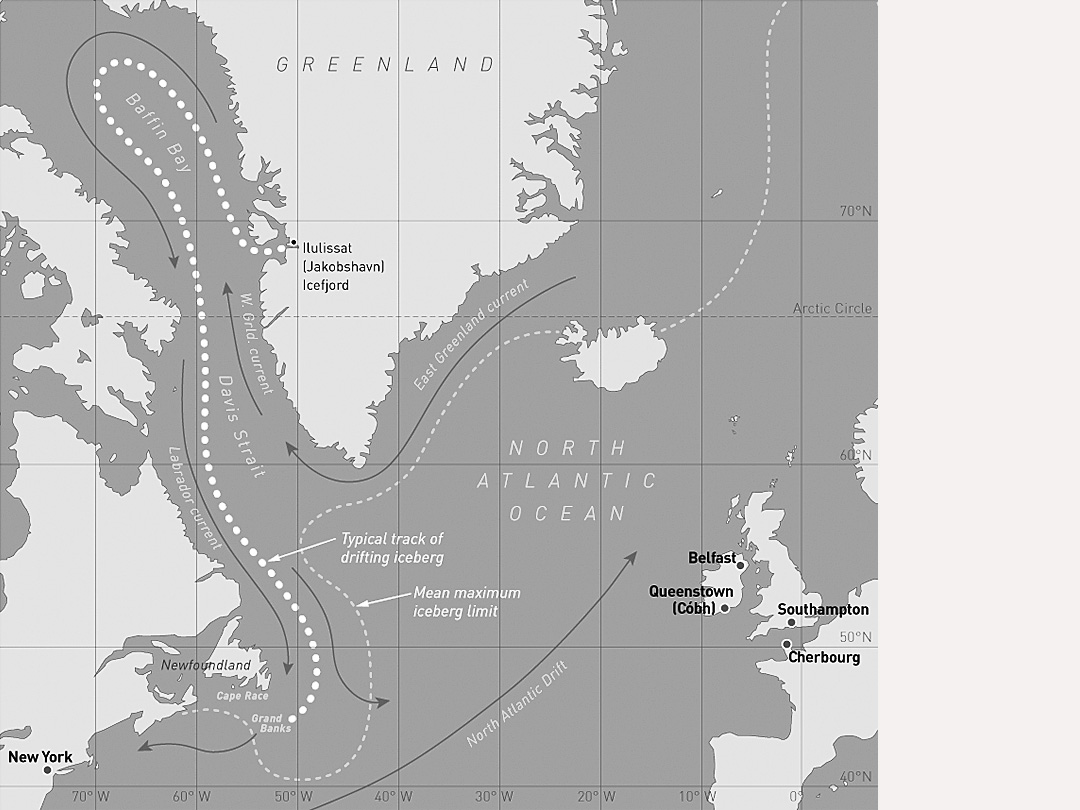
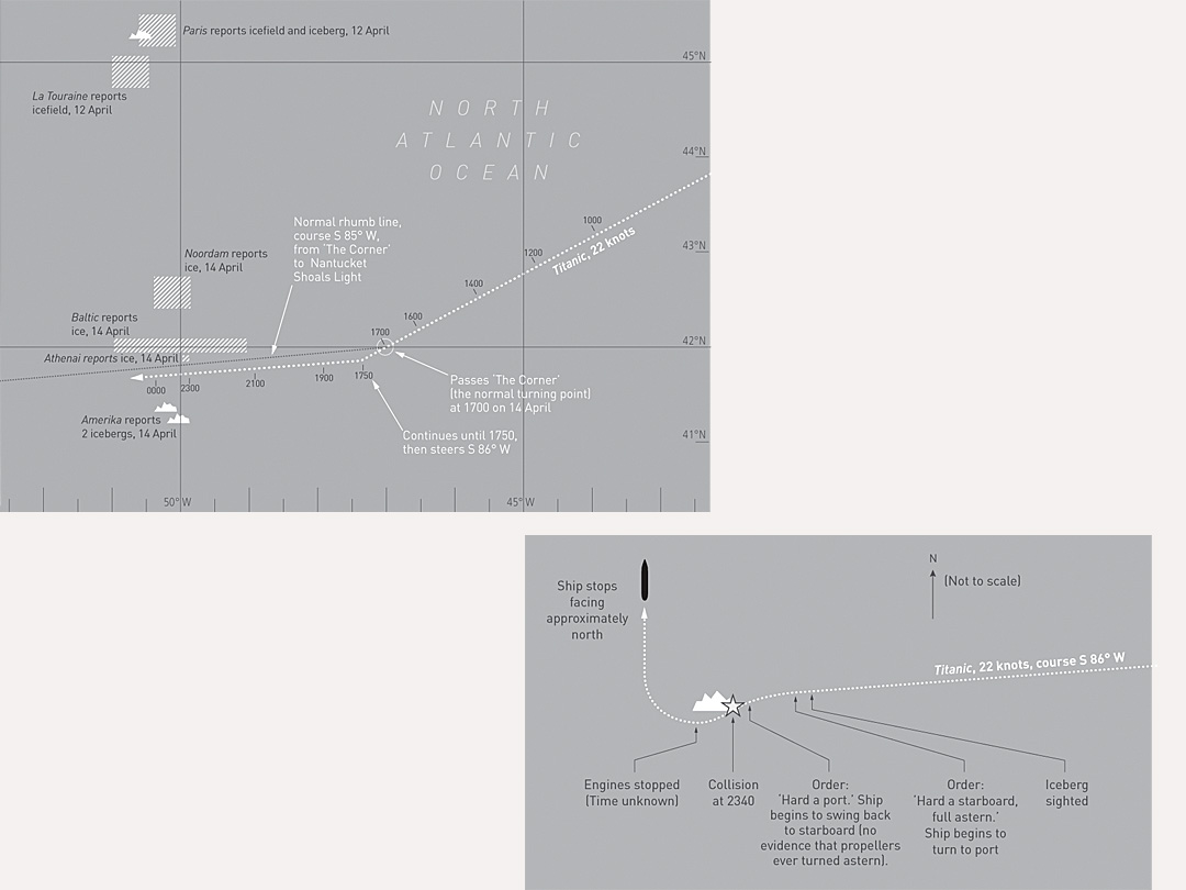
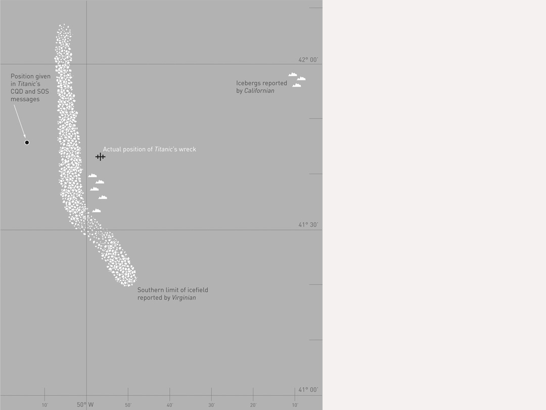
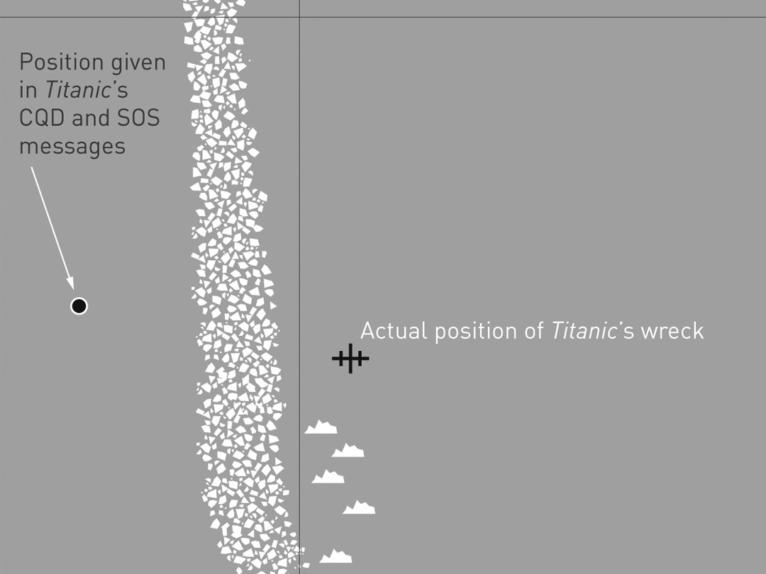
In this book, John Lang, a former Chief Inspector of Marine Accidents in the UK, re-examines the evidence presented to the original inquiry into the loss of the Titanic in the light of both the standards of the time and today’s knowledge. The design brief included the cover design and illustration, the page layout and as well as a series of maps, charts and diagrams, showing the reported positions of ships and ice on the night as well as their probable actual positions, deduced from the now known location of the wreck.